Local Number |
Well Depth |
aquifer |
Period of Record |
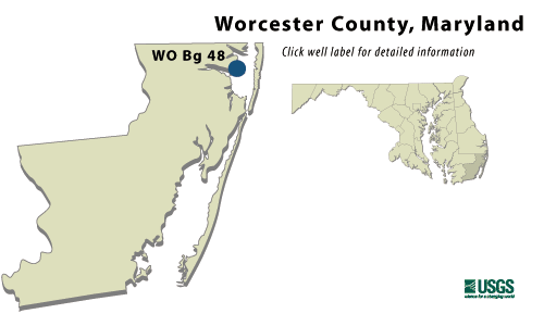
| WO Bg 48 | 420 ft |
Manokin aquifer of Upper Miocene Age |
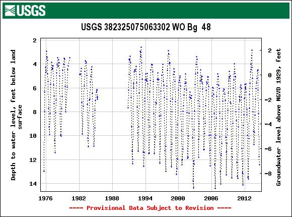
September 1975 to current year |
WO Bg 48
NWIS Historical Levels
WO Bg 48 on Groundwater Watch
|
WELL NAME |
WO Bg 48 |
|
SITE ID |
382325075063302 |
|
LOCATION |
Lat 38°23´25", long 75°06´33", Hydrologic Unit 02060010, at intersection of MD Rt. 90 and Isle of Wight Rd., Isle of Wight. Owner: U.S. Geological Survey. |
|
AQUIFER |
Manokin aquifer of Upper Miocene Age. Aquifer code: 122MNKN. |
|
INSTRUMENTATION |
Monthly measurements with chalked steel tape by U.S. Geological Survey personnel. Equipped with digital water-level recorder-60-minute recording interval from July 1985 to current year. |
|
CHARACTERISTICS |
Drilled, observation, artesian well, depth 420 ft; casing diameter 4 in., to 410 ft; screen diameter 4 in. from 410 to 420 ft. |
|
DATUM |
Altitude
of land surface is 5 ft
above sea level, from |
|
REMARKS |
Ocean City Groundwater monitoring network well. Water levels are affected by nearby Groundwater withdrawal, especially during summer peak demands. |
|
PERIOD OF RECORD |
August 1978 to current year. |
|
EXTREMES FOR RECORD |
Highest water level measured, 1.54 ft below land surface, February 24, 1998; lowest measured, 14.53 ft below land surface, August 8 and 9, 1999. |
|
COOPERATORS |
Maryland Geological Survey |
|
Download
the data for the entire
period of record for this
well |
|