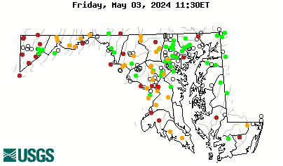
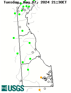
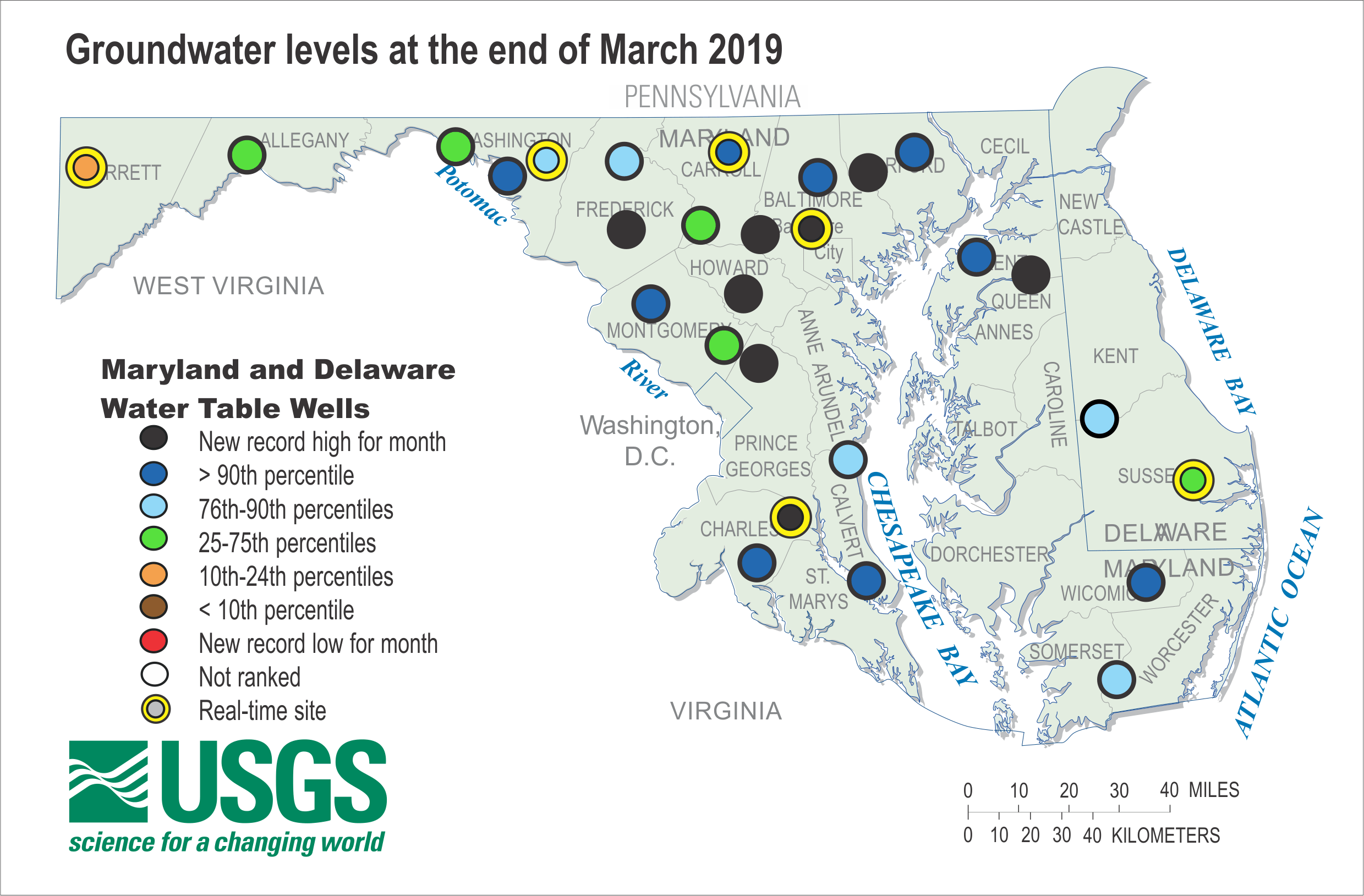
Maryland and Delaware - Climate Response - Water Table Wells
Groundwater levels for the monthly water conditions include a combination of real-time continuous (3 of the 28 wells) and discrete or hand-held (25 of the 28 wells) water levels. Discrete measurements include one measurement during the month and the date is indicated on the hydrograph. For the real-time wells, discrete measurements were used up until June 2010. From July 2010 onward, the discrete measurements were used for the real-time wells.
Criteria for selecting a groundwater site for assessing climatic conditions:
- Located in an unconfined (water-table) aquifer;
- Open to a single, known hydrogeologic unit/aquifer;
- Groundwater hydrograph reflects changes in climatic conditions;
- No indicated nearby pumpage and likely to remain uninfluenced by pumpage, regulated streamflow or changes related to human activities;
- Minimum period of record is 10 years of continuous/monthly records;
- Minimally affected by irrigation, canals, drains, pipelines, and other potential sources of artificial recharge;
- Well has casing--dug wells generally not used;
- Water levels show no apparent hydrologic connection to nearby streams;
- Well has never gone dry; and
- Long-term accessibility likely.
Click on a well symbol to display the 5-year hydrograph.
|
||||||
Maryland Counties
Delaware Counties
Other Jurisdictions
|
||||||