Local Number |
Well Depth |
aquifer |
Period of Record |
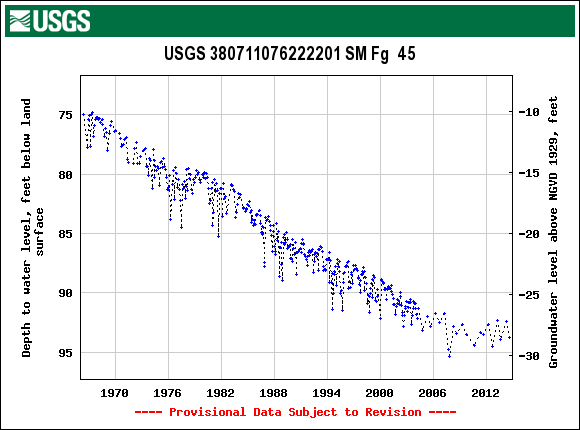
| SM Fg 45 | 436 ft |
Piney Point Formation of Middle Eocene age |
From May 1966 |
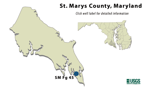
SM Fg 45
NWIS Historical Levels
SM Fg 45 on Groundwater Watch
|
WELL NAME |
SM Fg 45 |
|
SITE ID |
380711076222201 |
|
LOCATION |
Lat
38°07´11",
long 76°22´22",
Hydrologic Unit 02070011, |
|
AQUIFER |
Piney
Point Formation of Middle
Eocene age. |
|
INSTRUMENTATION |
Monthly measurements with
chalked steel |
|
CHARACTERISTICS |
Drilled,
observation, artesian well, |
|
DATUM |
Elevation
of land surface is 65 ft
above National Geodetic |
|
REMARKS |
Maryland Water-Level Network observation well. |
|
PERIOD OF RECORD |
May 1966 to current year. |
|
EXTREMES FOR RECORD |
Highest
water level measured, |
|
COOPERATORS |
Maryland Geological Survey |
|
Download
the data for the entire
period of record for this
well |
|