Local Number |
Well Depth |
aquifer |
Period of Record |
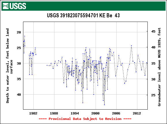
| KE Be 43 | 297 ft |
Magothy Formation of Upper Cretaceous age |
February 1979 to July 1979, December 1985, From October 1986 |
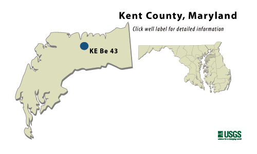
KE Be 43
NWIS Historical Levels
KE Be 43 on Groundwater Watch
WELL NAME |
KE Be 43 |
SITE ID |
391823075594701 |
| LOCATION |
Lat 39°18´23", long 75°59´45", Hydrologic Unit 02060002, at Kennedyville. Owner: U.S. Geological Survey. |
|
AQUIFER |
Magothy Formation of Upper Cretaceous age. Aquifer code: 211MGTY. |
|
INSTRUMENTATION |
Monthly measurements with electric tape by U.S. Geological Survey personnel. Twice yearly measurements from October 1986 to April 1991. |
|
CHARACTERISTICS |
Drilled, observation, artesian well, depth 297 ft; casing diameter 10 in., to 171 ft; casing diameter 4 in. to 275 ft, and 285 to 297 ft; screen diameter 4 in. from 275 to 285 ft |
|
DATUM |
Elevation of land surface is 65 ft above National Geodetic Vertical Datum of 1929, from topographic map. Measuring point: Top of casing, 2.41 ft above land surface. |
|
REMARKS |
Maryland Water-Level Network observation well. Water levels affected by nearby pumping. |
|
PERIOD OF RECORD |
February 1979 to July 1979, December 1985, October 1986 to current year. |
|
EXTREMES FOR RECORD |
Highest water level measured, 21.31 ft below land surface, June 5, 1979; lowest measured, 42.72 ft below land surface, March 27, 1996. |
|
COOPERATORS |
Maryland Geological Survey |
|
Download
the data for the entire
period of record for this
well |
|