Local Number |
Well Depth |
aquifer |
Period of Record |
| 2S5E-1 | 290 ft |
Patuxent Formation of Lower Cretaceaus age |
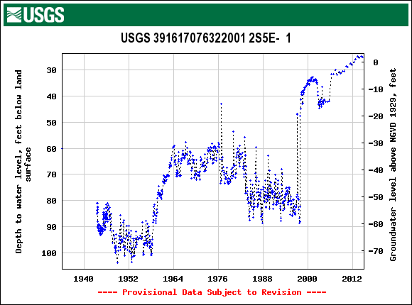
April 1943 to current year |
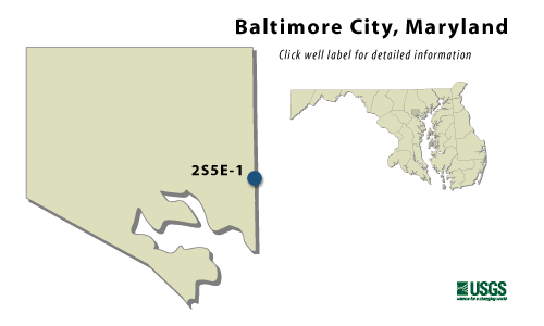
2S5E-1
NWIS Historical Levels
2S5E-1 on Groundwater Watch
WELL NAME |
2S5E-1 |
SITE ID |
391617076322001 |
|
LOCATION |
Lat 39°16´17", long 76°32´20", Hydrologic Unit 02060003, near Holabird Ave. and Pumphrey St. at Holabird Industrial Park. Owner: City of Baltimore. |
AQUIFER |
Patuxent Formation of Lower Cretaceaus age. Aquifer code: 217PTXN. |
INSTRUMENTATION |
Monthly measurements with electric tape by U.S. Geological Survey personnel. |
CHARACTERISTICS |
Drilled, observation, artesian well, depth 290 ft; casing diameter 14(?) in., to unknown depth. |
|
DATUM |
Elevation of land surface is 30 ft above sea level, from topographic map. Measuring point: Top of casing extension, 2.35 ft above land surface. |
REMARKS |
Maryland Water-Level Network observation well. Water Level reported 58 ft below land surface in 1934. |
PERIOD OF RECORD |
April 1943 to current year. |
EXTREMES FOR RECORD |
Highest water level measured, 33.97 ft below land surface, April 21, 2000; lowest measured, 103.70 ft below land surface, Oct. 15 1948. |
COOPERATORS |
Maryland Geological Survey |
|
Download the data for the entire period of record for this well |
|